Course Content
-
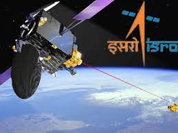
Introduction to Remote Sensing
-
Stages in Remote Sensing
-
Electromagnetic Radiation (EMR)
-
Geostationay and Sun Synchronous Satellites
-
Type of Remote Sensors
-
Multispectral Scanner
-
Resolutions
-
Resolving power of satellites
-
Data Products
-
Interpretation of Satellite Imageries
Requirements
- Basic understanding of Science and Mathematics
Description of Course
Remote Sensing has become key technology tools for the collection, storage and analysis of spatially referenced data for resource planning and decision making. Remote sensing is finding its way into more and more classrooms, as satellite images allow students to take a look with their own eyes and gain knowledge by actually seeing what otherwise was taught only theoretically. The course on Basics of Remote Sensing Technology provides an opportunity to students to learn Remote Sensing and Geoinformation Science. The course contains an introduction to remote sensing for school children as per NCERT syllabus. With this course the students will become aware of remote sensing definition, its applications, physics behind remote sensing, various terms such as resolution, orbit, swath etc., Difference between Active and Passive Sensors, Categorization of Remotely Sensed Data Products, elements of image interpretation nature of satellite imagery and how it can be used to monitor environmental issues. The concepts are explained in simple language using images and animations. The course is intended to engage secondary and higher secondary students to create awareness about Remote Sensing Technology & its use for the study of mother planet Earth and its environment through informative lectures.
Targeted Participants:
- Students of Class 8th onward
Course Instructors
- Scientists and Engineers of various centers of ISRO